 Kilkenny County Council

Traffic Survey Sustainable Links Programme – Abbey Road, Ferrybank
Traffic surveys are being undertaken on behalf of Kilkenny County Council to support development of the Sustainable Links Programme – Abbey Road, Ferrybank.
The purpose of the survey programme is to provide an evidence base for transport planning activities, including:
- Understanding existing travel behaviour and traffic patterns;
- Assessing the operation of the transport network;
- Identifying existing and future transport challenges;
- Supporting transport modelling and forecasting exercises;
- Informing future infrastructure investment decisions; and
- Supporting the development of transport policies, strategies and interventions.
The surveys comprise of Junction Turning Counts (JTCs) at locations throughout the study area. Please find further details of the locations in the survey specification.
Survey cameras may be used to capture traffic movements over specified survey periods. The information collected is analysed to produce aggregated traffic data and traffic statistics. The outputs provided to Kilkenny County Council and TOBIN do not require identification of individual members of the public and are used solely for transport planning purposes.
The survey programme is being delivered by IDASO Ltd under appointment by Kilkenny County Council and managed by TOBIN.
Traffic Survey Cameras will be installed as shown on the map below to capture information over a period of 1 day (10 November 2026) for a duration of 12 hours, from 07:00 to 19:00.
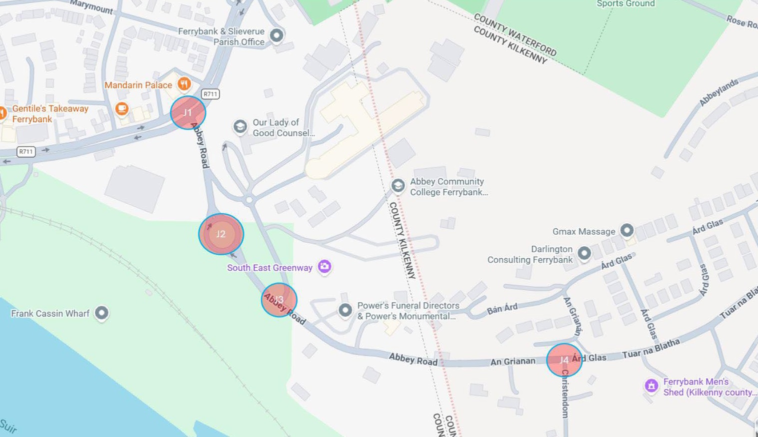
Map source: Google Maps, via the surveying company.
Location Map: Sustainable Links – Abbey Road, Ferrybank, Co. Kilkenny

